The technology behind the Gjellestad ship find
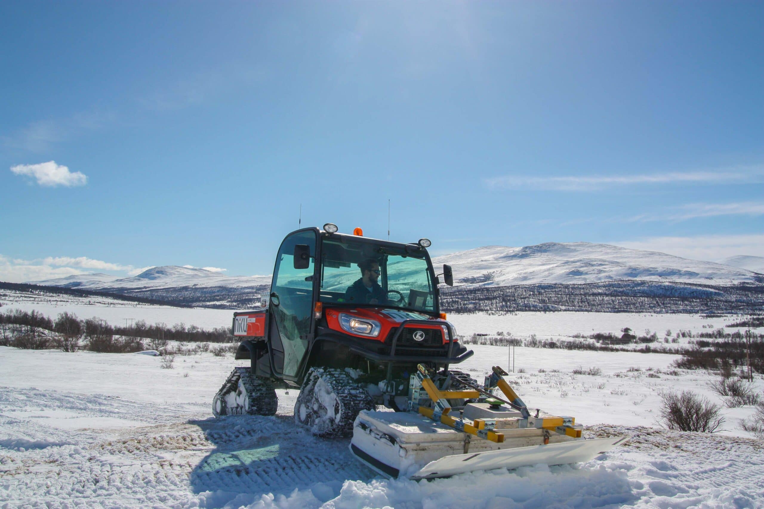
With the help of newly developed motorised georadar systems, NIKU's archaeologists did some major discoveries at Gjellestad - including a Viking Ship. But how does the technology work and what will happen next?
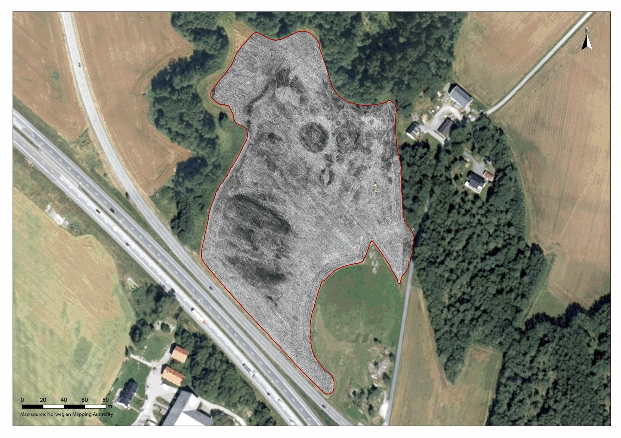
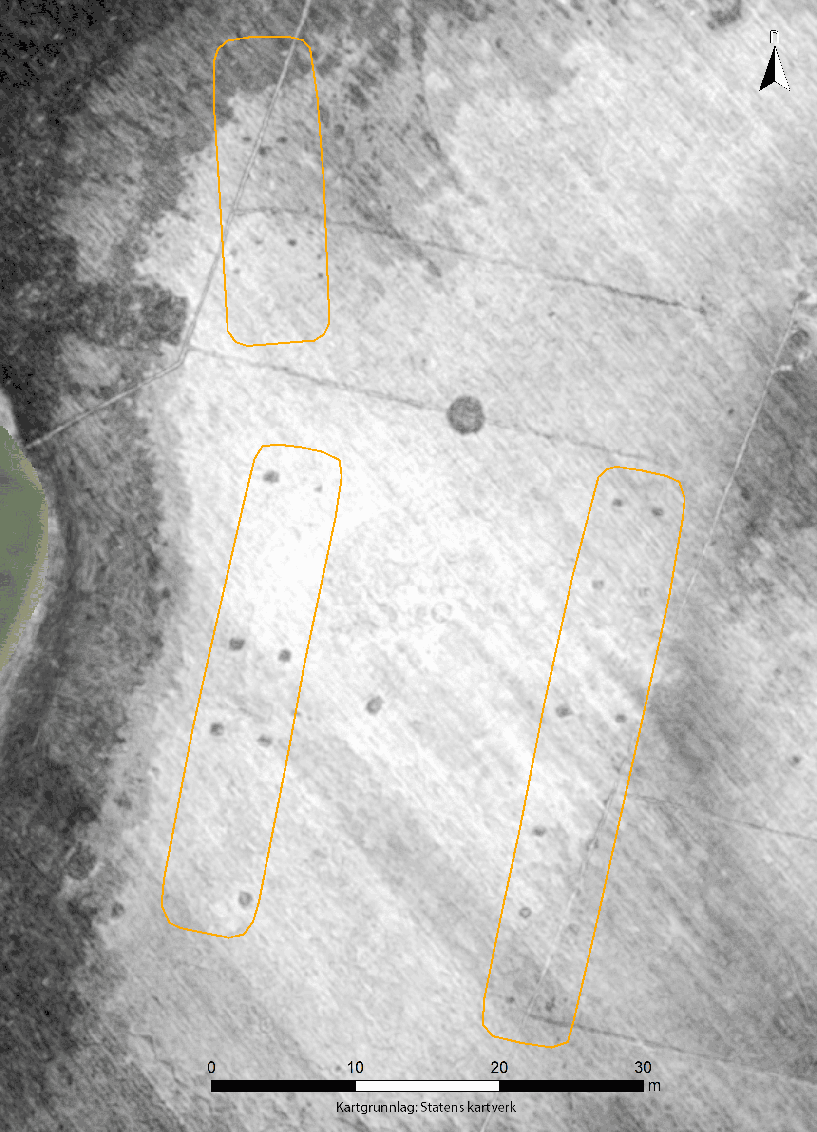
The archaeologists were able to see five long houses, at least 10 burial mounds and what is probably a Viking. The find has caught worldwide media attention.
Because of this spectacular finds the technology behind the discovery are also getting more attention.
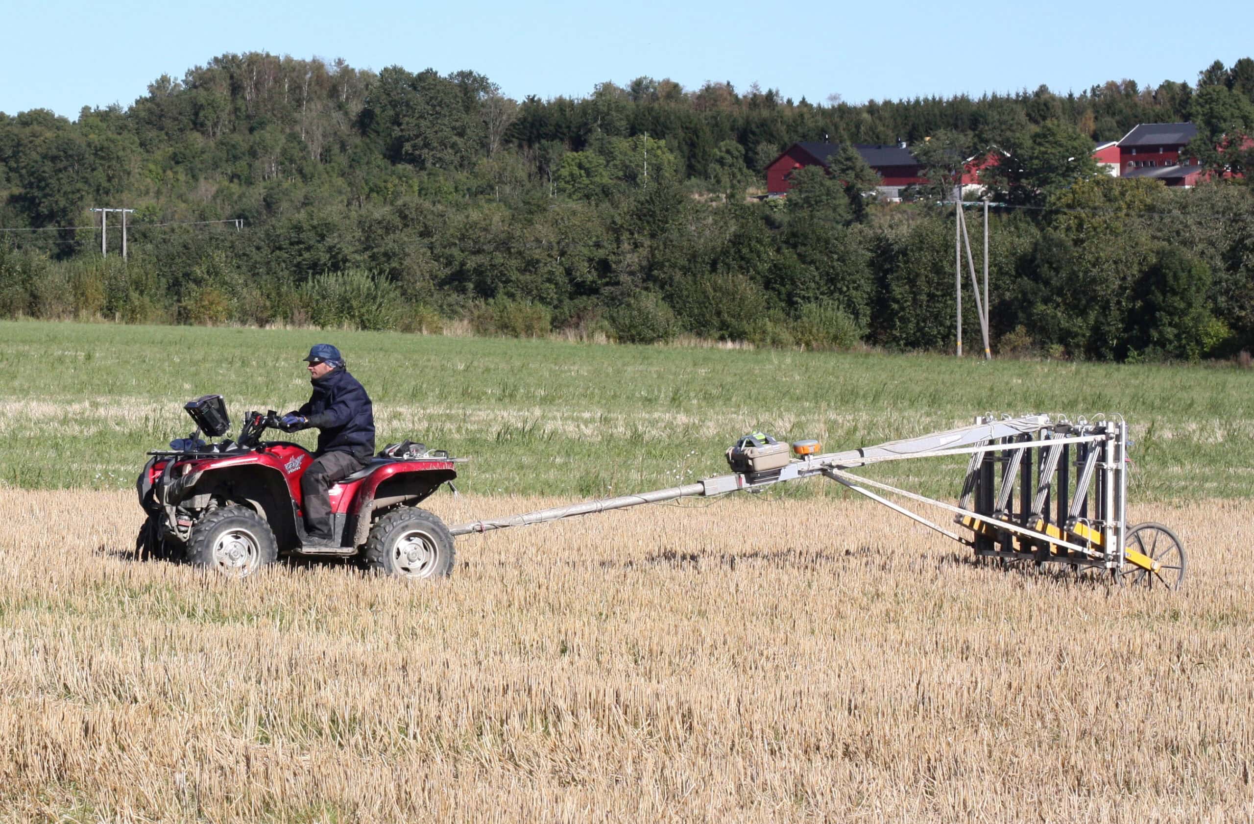
The motorised georadar system can be compared to an echo sounder that sends a signal down the ground with a reflex. Based on these signals, archaeologists map out areas that stand out from its surroundings – so-called anomalies.
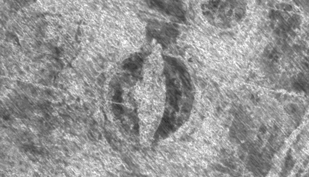
– An anomaly is simply something that differs from what lies around. At Gjellestad, one of the these was a clear ship-shaped anomaly centered in the middle of a burial mound, says Lars Gustavsen, archaeologist at the Norwegian Institute of Cultural Heritage Research (NIKU)
The georadarsystem used was a MIRA from Guideline Geo and further developed for archaeological purposes by the International Research Institute, Ludwig Boltzmann Institute for Archeological Prospection and Virtual Archeology (LBI). LBI has been a partner organization of NIKU since 2010.
Read more about the Department of Digital Archeology here.
Technology and interpretation
The georadar sends out radar signals that descend through the ground layers, when they encounter resistance, parts or the whole signal are reflected to a receiver. The result will be gray scale images for every 5 cm down in the soil layers.
– The bright parts of the image are areas where the signal penetrates the underground evenly and just disappears into the underground. The dark parts are where the signal is reflected back due to changes in layering or substructures. When we put the individual performance images together for an animation, the anomalies emerge in an easy-to-understand way, says archaeologist at NIKU, Erich Nau
Further, the archaeologists interpret the results to assess whether they may represent archaeological structures underground. This way you can get an idea on where it might be worth doing closer surveys.
Georadar results are conditional
How good these results will be depends on several factors. Both soil, moisture in the soil and depth have something to say, as are modern structures and other disturbances in the area.
At Gjellestad, the archaeologists have two datasets. A smaller part of the area was studied already in April when the ground was relatively wet. A complete dataset was collected in August when the ground was dry. The difference in moisture in the subsoil is also reflected in the results according to Gustavsen and Nau.
– In the data set from April when it was very wet, we see more of what we think is the boat’s keel. We saw less of it in August when it was dry. And we think it’s the different levels of moisture in what we think is wood that comes into play here, “says Nau.
Hva skjer videre på Gjellestad?
Arkeologene fra NIKU ønsker nå å gjøre flere undersøkelser på området. I tillegg til ytterligere georadarundersøkelser vil de også ta i bruk en rekke inngrepsfrie digitale metoder.
Georadaren reagerer mest på såkalt dielektrisk permittivitet, som er en egenskap i jordsmonnet og i de arkeologiske strukturene under bakken.
– Ved bruk av andre geofysiske metoder, som ekesempelvis geomagnetikk eller elektromagnetisk induksjon vil det være mulig å samle ytterlige informasjoner om magnetiske og elektriske egenskaper av undergrunnen. Noe som kan potensielt gir mer og andre informasjoner om bevaringsforhold av skipsfunnet og plassering av jerngjenstander, sier Nau
Nau og Gustavsen ønsker å finne ut mest mulig ved bruk av inngrepsfrie metoder før det evetnuelt skal graves på området.
– Dette kan sammenlignes med inngrepsfrie medisinsk undersøkelse som røntgenbilder før en kirurg begynner med selve operasjonen.
Riksantikvaren har kjøpt fri grunneier og bonde Olav Jellestad i et år for at det skal gjøres flere undersøkelser på Viksletta.