Innovative Technology: Robot to Find Norway’s Hidden Cultural Heritage
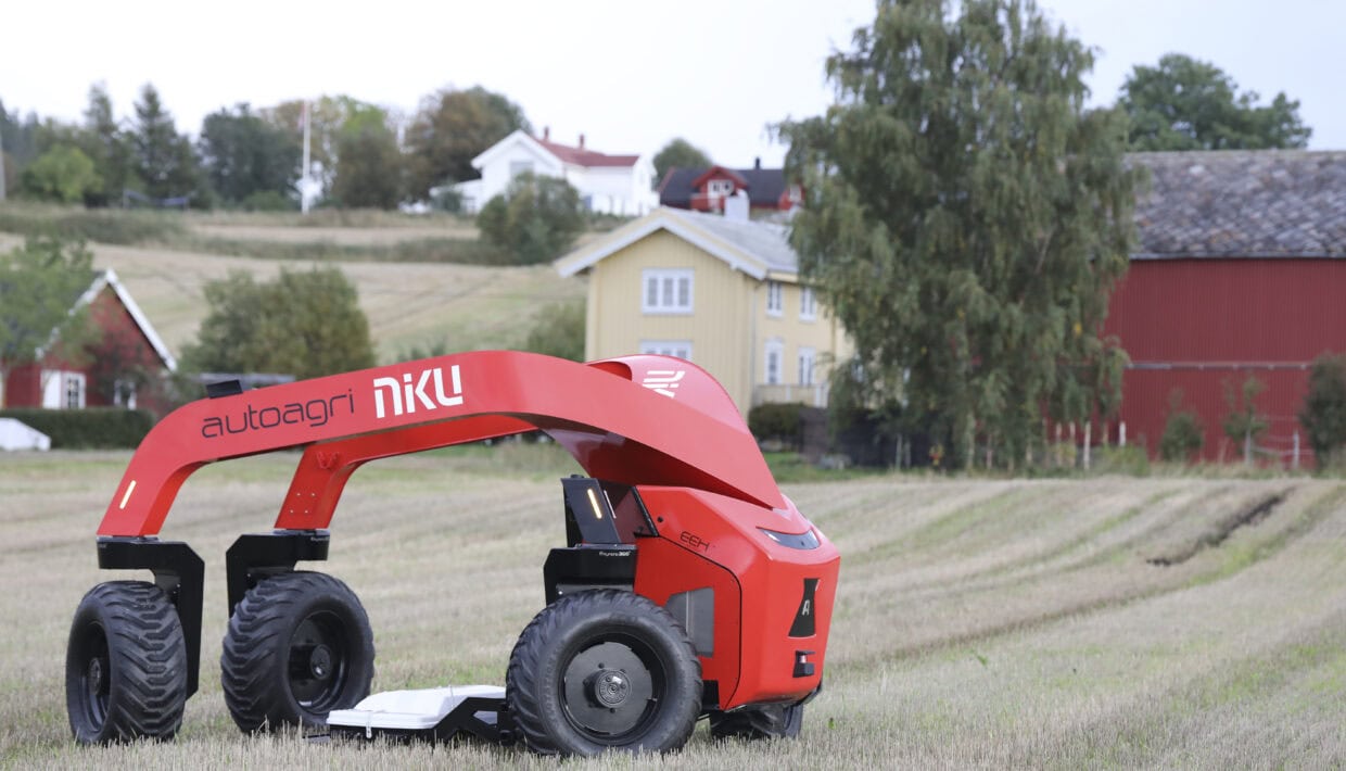
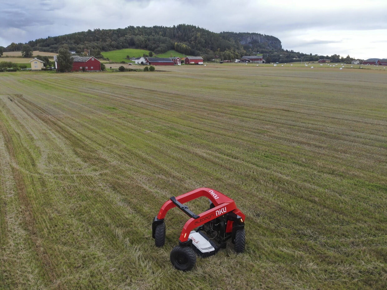
The Norwegian Institute for Cultural Heritage Research (NIKU) and AutoAgri are launching a revolutionary self-driving ground penetrating radar (GPR) for archaeological survey. The technology promises increased efficiency, climate friendly solutions, and accurate mapping of hitherto undiscovered cultural heritage.
First of its kind
AutoAgri is a Norwegian technology company, that develops and manufactures autonomous and electric implement carriers for agriculture, parkland, and survey.
Guideline Geo/ MALÅ, based in Sweden, is a leading technology company with a focus on geophysical measurement equipment and is a supplier of georadar technology.
NIKU is an independent research and expertise environment for Norwegian and international cultural heritage. NIKU works with the development and use of high-tech solutions in connection with archaeological mapping.
AutoAgri is an innovative technology company from Trondheim that develops autonomous vehicles for use in agriculture, park management and surveying. The newly developed GPR robot is the first of its kind and represents a significant technological development in archaeological prospection.
This ground-breaking system combines AutoAgri’s autonomous vehicle with the latest version of Guideline Geo/ MALÅ’s multi-channel GPR system. The project’s main goal is to integrate these two components mechanically, electronically, and using specially developed software from NIKU and AutoAgri.
– We are proud of the close and fruitful collaboration we have with both AutoAgri and Guideline Geo/ MALÅ. This is a great example of how interdisciplinary collaboration can produce innovative technology that serves society by preserving our common cultural heritage, says Erich Nau, NIKU’s project manager for the development of the new system.
Tested at locations along the Trondheimsfjord

A prototype of the system was completed in 2021, and now the fully developed system is in use.
The first operation with the self-driving GPR takes place at Auran and Vinnan, two farms in Stjørdal municipality, in collaboration with the NTNU University Museum, and archaeologists from Trøndelag county authority.
The survey is part of the project “Farmers on Land, Vikings at Sea,” which aims to explore the Late Iron Age and the Viking Age to better understand Norway’s history.
Based on older archaeological and antiquarian finds in Nordmøre and Trøndelag, the archaeologists want to carry out new studies of the Late Iron Age and the Viking Age towards Norway’s national anniversary in 2030.

“Farmers on land – Vikings at sea. Trøndelag until 1030” is a collaborative project between NTNU/Vitenskapsmuseet, Stiklestad National Cultural Center (SNK), Trøndelag County Council and the Norwegian Institute for Cultural Heritage Research (NIKU)
The project sheds light on the extensive upheavals that took place in society in the latter part of the Iron Age (Merovingian and Viking) and the early Middle Ages. Central are processes related to the formation of the state, the change of religion and the national assembly in the period leading up to the battle at Stiklestad in 1030
Already last year, NIKU made new and particularly exciting discoveries with georadar on the farm Vinne in Verdal.
Now the archaeologists want to see what else can be hidden underground at Auran and Vinnan farms in Stjørdal.
They hope the findings can help to shed light on the formation of the state, the unifying of Norway, and the change of religion in Norway a thousand years ago.
– Many wonderful finds have previously been made here using metal detectors. Such findings often indicate structures under the topsoil. Perhaps the new vehicle will reveal more ploughed-over graves, a trading post, or other traces of activity from the Viking Age? says Knut Paasche, head of the Digital Archeology department at NIKU.
Efficiency and precision
The new GPR that is now being tested seems very promising. The autonomous system performs the data collection alone and without a driver. But the archaeologist still has a crucial role; instead of sitting in a tractor for many hours first and interpreting the data afterward, the archaeologist can now work continuously with the data in real time.
– Automatic transfer of data to a PC means that we can already start processing and interpreting the data in the field, says Knut Paasche.

The new GPR system delivers significantly higher resolution and a clearer signal than the equipment used until now. This makes the results better and more accurate and will lead to improved archaeological results.
This equipment is particularly well suited for recording traces of archaeological structures, which are classified as automatically protected cultural heritage, hidden under cultivated land.
Especially in the case of archaeological registrations in advance of major infrastructure projects, such as roads and railways, this can make the work more efficient. The use of motorized, now also autonomous, GPR systems will be a good supplement to existing archaeological recording methods.
Climate friendly technology
Cultural heritage conservation is an important part of overall nature and environmental protection. The robot is fully electric and helps to reduce climate emissions and remove noise pollution. Previously, these tractors were diesel powered.
– Climate friendly solutions reducing emissions at the same time as they help protect hidden cultural monuments under the ground is as a double blessing in this context, says Knut Paasche.

