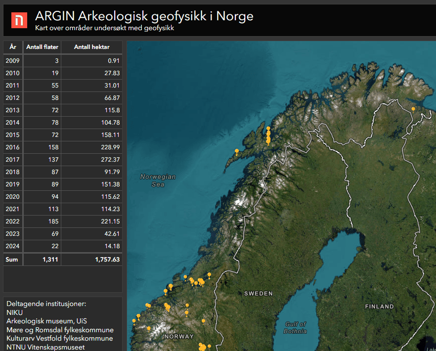
NIKU (with partners) has created an open map service with an overview of projects completed with archaeological geophysics in Norway. Almost 2000 hectares have been studied and 300 project reports are now available through the webpage argin.no.
Historic discovery: Karl XII’s hidden transport route uncovered at Blomsholm
New geo-radar technology has uncovered traces of Karl XII's spectacular overland transport of galleys in 1718. The discovery provides new insight into one of Sweden's most fascinating military operations.
Georadar project at Blomsholm
- The project is initiated by NIKU.
- Project manager: Erich Nau
- Conducted in collaboration with colleagues from Arkeologerna in Sweden (Bengt Westergaard), VIAS/University of Vienna (Immo Trinks) and Bohusläns Museum (Roger Nyqvist).
- Stay tuned to NIKU’s channels for more results from this work
- Instagram: @niku_digitalarchaeology
In December, the Norwegian Institute for Cultural Heritage Research (NIKU) carried out a georadar project at Blomsholm in Bohuslän, Sweden. The project was carried out in close collaboration with Arkeologerna, Bohusläns Museum and the Vienna Institute for Archaeological Science (VIAS).
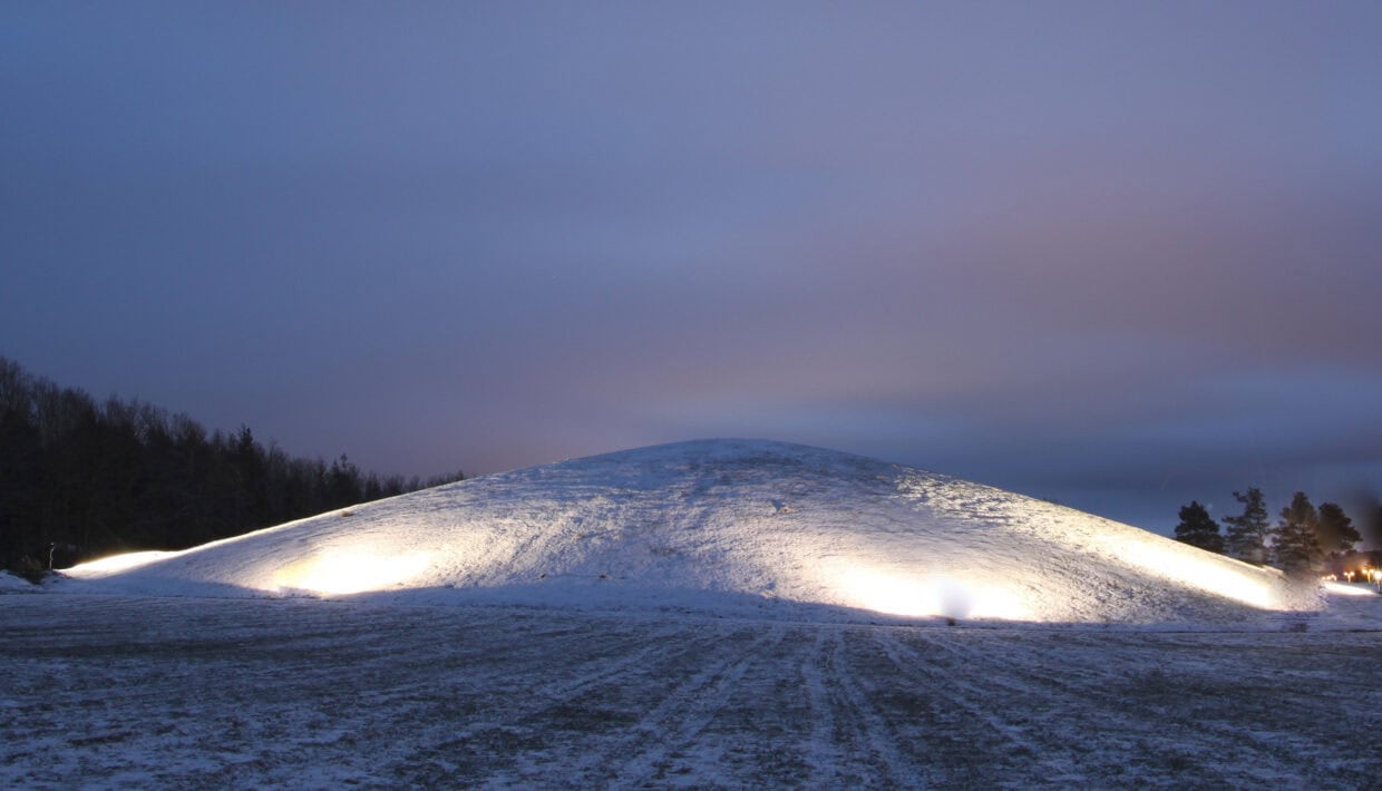
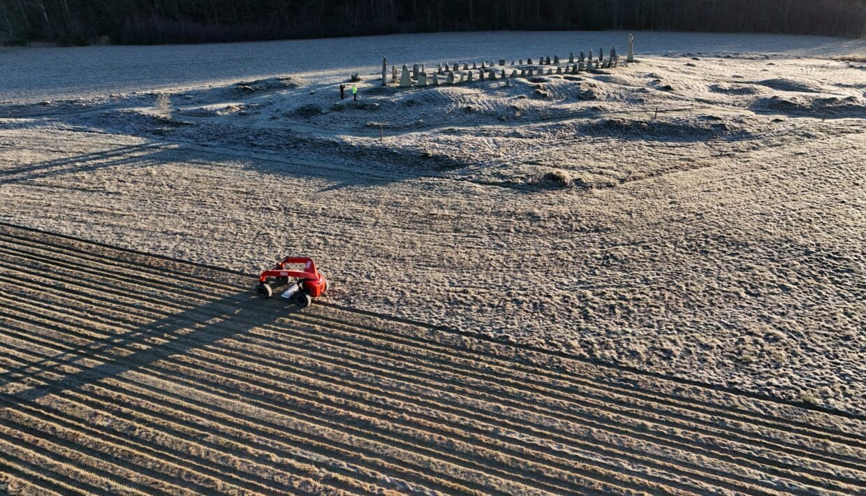
The background to the project was a large-scale test of the newly developed AutoMIRA system. According to archaeologist and project manager Erich Nau, Blomsholm was chosen as the test site because of its rich cultural heritage. The area is home to Sweden’s second largest stone ship, the impressive Grönehög mound, several burial mounds, a circular stone settings and settlement traces.
– This area provides a unique insight into the landscape of the past, but we didn’t expect to find a hidden historical route. The survey shows clear traces of the Galärvägen road from 1718 and is clearly one of the most exciting discoveries from this survey, says Nau.
Blomsholm – a unique cultural landscape
- Blomsholm is recognised as one of Sweden’s most important cultural heritage sites, with several spectacular monuments.
- The large ship seal from the Roman Iron Age consists of 49 stones and is the second largest in Sweden.
- Storhaugen Grönehög, dating from the Migration Period, is one of Scandinavia’s largest burial mounds and is strategically located on the old coastline.
- The burial mounds and dome rings in the area testify to extensive activity in the Iron Age and Viking Age.
Galärvägen: A hidden historical route
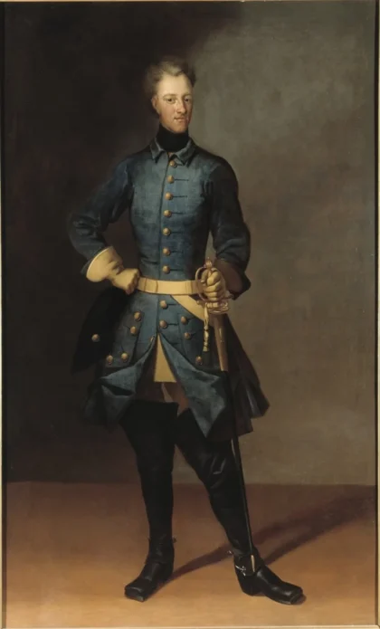
In 1718, Swedish King Karl XII ordered twelve large ships to be moved overland between Strömstad and Iddefjorden. The aim was to attack Fredriksten fortress near Halden from an unexpected direction, as the fjord’s inlet from the sea was blocked. It was a massive operation that required vessels weighing up to 30 tonnes to be transported over land.
According to Nau, little was known about this transport route before it was discovered in NIKU’s georadar data. Instead of the expected prehistoric remains in the vicinity of the impressive Iron Age stone ship at Blomsholm, the survey revealed traces of Charles XII’s transport route.
Unique traces of Galärvegen with the help of georadar
Galärvegen is the name of the route used by King Karl XII and his 800 soldiers to transport twelve large galleys overland from Strömstad to Iddefjorden during the military campaign against Halden Fortress on the Norwegian side of the border.
The transport, which began on 26 June 1718, required several months of hard work. The heavy vessels were moved using hoists, blocks, horses and greased logs, over 25 kilometres and through challenging terrain.
Preliminary analyses from NIKU’s georadar survey have revealed several exciting findings. The georadar data from the AutoMIRA system shows several parallel, linear structures that correspond well with this historical transport route. These structures start at the southern boundary of the survey area and can be followed over a length of 160 meters, just west past the ship seal. The tracks are particularly evident in the southern section and are interpreted as the remains of logs that were laid along the road to stabilize it in soft areas. Here, the parallel tracks have an outer width of approximately 8 meters and an inner width of 3.5 meters. Further north, near the ship seal, only the 3.5-metre-wide structure is visible.
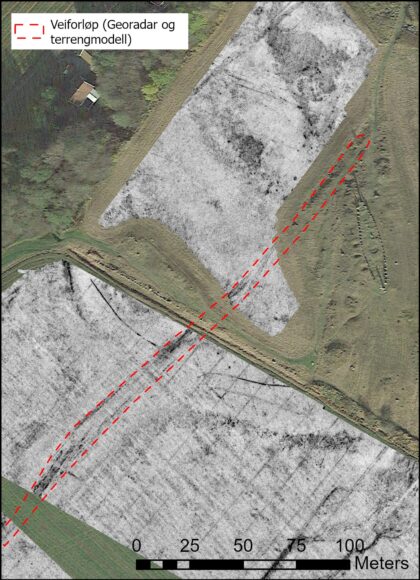
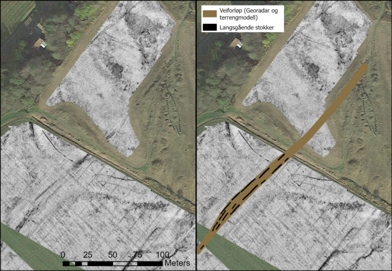
In addition to the traces of Galärvägen, we have found structures that are preliminary interpreted as prehistoric burial mounds and settlement traces.
During Charles XII’s campaign, the area around Blomsholm was used as a field hospital, and several soldiers were buried in the ship setting. This makes the data challenging to interpret, as the area has been affected by many different activities over the centuries.
According to Roger Nyqvist from Bohusläns Museum, these discoveries give us a unique opportunity to link historical documents directly to archaeological traces in the landscape:
– The discovery of Galärvegen gives us a unique opportunity to combine historical sources with modern technology to explore and communicate important parts of our common cultural heritage. NIKU’s georadar survey is a valuable contribution to our understanding of Blomsholm as a complex and dynamic cultural landscape through several time periods.
NIKU – Digital archaeology
- NIKU’s Department of Digital Archaeology works with various digital methods aimed at researching and documenting cultural heritage from older and more recent times.
- We use traditional registration, documentation and drawing techniques in combination with a visual, spatial and digital 3D world.
- We use techniques such as laser scanning from aircraft and the ground, image-based modeling (photogrammetry) and RTI (Reflectance Transformation Imaging).
- We use ground penetrating radar (GPR) and magnetometers for archaeological geophysical surveys.
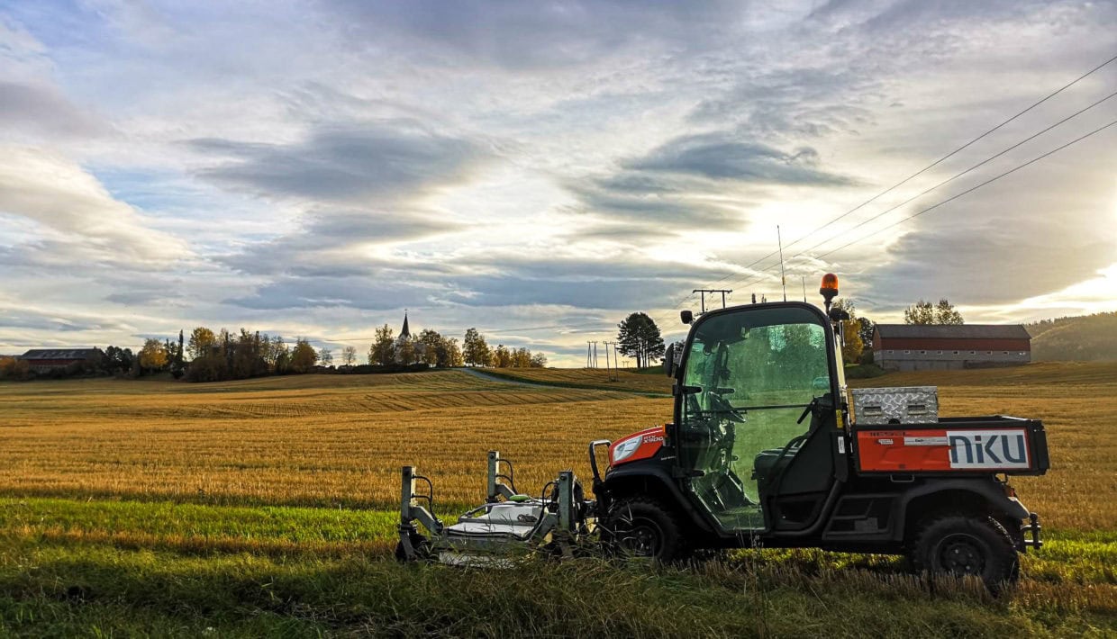
- The AutoMIRA system used by NIKU is customised for large infrastructure projects such as roads and railways.
- Interested in seeing some examples from previously completed projects? Take a look at our collection of examples – Cultural heritage digital – see what we do! (In Norwegian)
The AutoMIRA system – a revolution for geophysical surveys
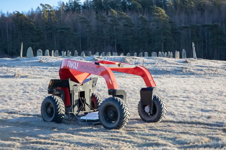
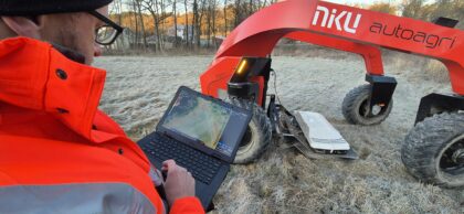
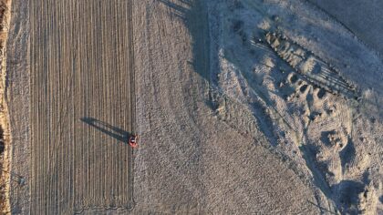
NIKU’s survey at Blomsholm marked an important milestone in the development of the AutoMIRA system, an autonomous georadar system developed by NIKU in collaboration with the Norwegian company AutoAgri.
The system is designed to cover large areas quickly and efficiently, with a capacity of up to 5-7 hectares per day. Nau reports three days of continuous surveys with no major technical issues:
– We were able to survey a total area of 8.5 hectares in just three days. Although there is a need for some more upgrades in the future, this confirms the robustness of the system.
This means that from the next field season, NIKU will be able to cover larger areas than previously and quickly collect high-resolution georadar data. The autonomous system, together with the latest generation of georadar (MIRA HDR, GuidelineGeo), will significantly increase both the capacity and accuracy of the data, according to Nau.


