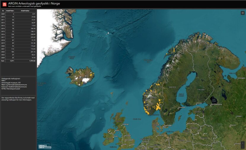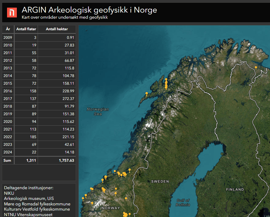
NIKU (with partners) has created an open map service with an overview of projects completed with archaeological geophysics in Norway. Almost 2000 hectares have been studied and 300 project reports are now available through the webpage argin.no.

Argin.no – Archaeological Geophysics in Norway
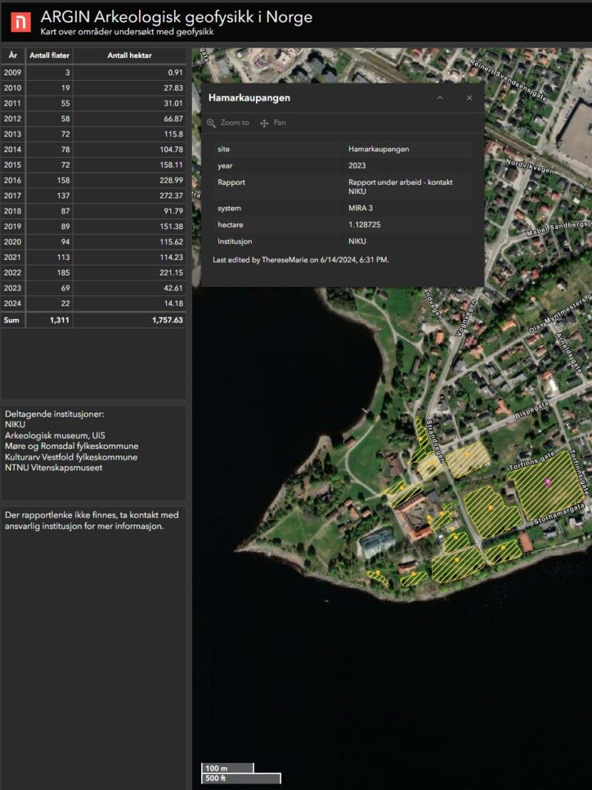
Argin.no – Archaeological Geophysics in Norway is an open map service that provides an overview of archaeological geophysical surveys.
The map service provides a good overview of areas surveyed with ground-penetrating radar, as well as metadata linking to published reports. Argin is a tool useful for cultural heritage management, agriculture, landowners, developers and others involved in land-use planning work.
From 2007 until today, a large number of archaeological geophysical surveys have been conducted. NIKU alone is approaching 250 different assignments by 2024.
From the outset, the Norwegian Institute for Cultural Heritage Research (NIKU) has been a key player in archaeological geophysical surveys. The University Museum – NTNU has also been at the forefront of this field. Subsequently, other actors have joined in, including Vestfold County Municipality, Archeological Museum at the University of Stavanger – Museum of Archaeology, and Møre og Romsdal County Municipality.
Together with these Norwegian actors, NIKU has established the map service, which is continuously updated with new data.
Contact: Knut Paasche
- Status In progress
- Client Norwegian Institute for Cultural Heritage Research (NIKU)